Barrhead Road Active Corridor (Newton Mearns)
Consultation has concluded
Next Steps
This consultation has closed - thank you to everyone who took part. We'll now consider your comments, and write a report responding to the issues you've raised, while we work to finalise the detailed design for Barrhead Road. Construction of the project will be subject to funding and political approval.
The information below was published when the consultation opened and will be kept as an archive.
Background
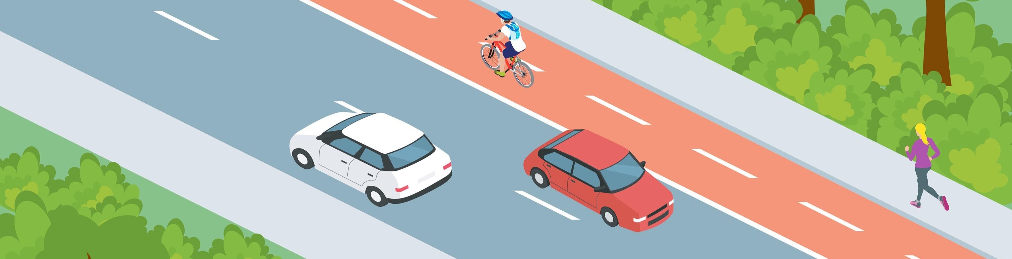
East Renfrewshire Council is proposing an improved active travel route between Barrhead and Newton Mearns. We want to make it safer and easier for people of all ages and abilities to walk, cycle and wheel (using a scooter, mobility aid, or wheelchair) in the area - improving connections between communities and the Dams to Darnley Country Park.
These proposals contribute to our ambitions to develop an accessible and connected network of active travel and public transport routes. This is a key part of our Community Planning Partnership's vision, 'A Place to Grow', which sets out our shared hopes and aspirations to make East Renfrewshire a place where everyone can flourish, thrive and grow.
Q: Who's funding this project?
A: The funding to design the project has been provided by Transport Scotland through Sustrans Places for Everyone. The proposals have been developed by Stantec on behalf of East Renfrewshire Council. The design process is due to finish later this year. We hope to build the project in the next financial year, but this will depend on funding from Transport Scotland's Active Travel Infrastructure Fund.
Have Your Say
In 2022, we consulted on early plans for Barrhead Road (in Newton Mearns) and Aurs Road (in Barrhead). Since then, we've reconsidered our plans for Barrhead Road to make better use of the limited space and improve the infrastructure for active travel.
The current project stage involves presenting new draft design drawings for Barrhead Road, considering your feedback, then completing the design process in consultation with the community and stakeholders.
We're keen to hear your thoughts on our proposals - please read the information below, then complete the quick survey to let us know what you think. The closing date for responses to be received is Sunday 26 October.
We've also organised a drop-in event where you can talk to the project team. This will take place at Mearns Library on Wednesday 1 October from 3-7pm.
Project Area and Phases
The project has been split into three phases:
- The first phase involves realigning Aurs Road and building separate paths for walking, wheeling and cycling beside it. This will include a new promenade overlooking Balgray Reservoir, creating a new public space within the heart of the Country Park. This section is currently under construction.
- The second phase will improve traffic calming on the Aurs Road service road in Auchenback, Barrhead. These plans haven't changed significantly since the previous consultation and we plan to build this section next year.
- The third phase would improve paths and crossings on Barrhead Road in Newton Mearns. It would also include priority for people walking, wheeling, and cycling at junctions; traffic calming measures; improved road crossings; and new signage. We've made significant changes to our plans for this section since the previous consultation, which is why we're now consulting again.
All of these sections will connect to each other to provide a continuous active travel route between Barrhead and Newton Mearns. In future, the route could also connect to the improvements for active travel on Ayr Road we're considering as part of the A77 Active Corridor project. The map below shows the proposed active travel network in the area:
 Barrhead Road Active Corridor location plan.
Walking and Wheeling
Crossing locations
We want to make it easier for people to cross the road in the project area. We plan to keep all the existing traffic light controlled crossings in their current locations, and we're also proposing several new crossings to provide better access between communities, schools and bus stops. The map below shows the proposed crossing locations:
 Proposed controlled crossing types and locations.
Zebra crossings
At the two junctions between Barrhead Road and Westacres Road, we're proposing new zebra crossings with parallel cycle crossings. These would give priority to people walking, wheeling and cycling along the paths on Barrhead Road. Vehicles entering or exiting Westacres Road would need to give way to people crossing.
 Proposed zebra crossing design at Westacres Road.
Continuous footways
We also want to give priority to people walking and wheeling even when traffic lights or zebra crossings aren't provided, so we're proposing continuous footways at many of the other side road junctions.
Our plans include continuous footways at most of the side roads along Barrhead Road - except Greenfarm Road (where a set back drop-kerb crossing will be provided instead) and Westacres Road (where zebra crossings will be provided instead).
Q: What is a continuous footway?
A: The updated Highway Code Rule 170 states that, when you're driving or cycling, you should give way to pedestrians crossing or waiting to cross a road you're turning in or out of. Continuous footways support this rule by providing a strong visual impression that pedestrians have priority. They also reduce vehicle speeds by acting as a speed bump between the main road and the side road. This helps to prioritise walking and encourage lower speeds at junctions and residential streets.
 Proposed continuous footway design at Rodger Avenue.
Cycling
Aurs Road
Due to limited space across the M77 bridge, we're proposing a shared path for walking, wheeling and cycling on the south side of this part of Aurs Road. This would connect to Phase 1 of the project towards Barrhead. The path on the north side of the road would remain a normal footway and would not allow cycling.
 Proposed shared path on Aurs Road at the M77 bridge.
 Typical cross-section with shared path.
Barrhead Road
On most of this section, we're proposing a new two-way cycleway along the south side of Barrhead Road. The cycleway would be separated from the footway and the road by kerbs. Providing all road users with their own space would make travelling safer and more comfortable for everyone. People cycling along Barrhead Road would have clear priority over people driving in and out of the side roads.
There isn't enough space on Barrhead Road to provide separated cycleways along the entire length, so we'll need to provide shared paths on some sections. Overall, about two-thirds of the length of Barrhead Road would have separated footways and cycleways and about one-third would have shared paths. The shared paths would be similar to those on Aurs Road as shown above.
Q: Why have you chosen a two-way cycleway?
A: During the first consultation in 2022, we showed a concept design with one-way cycleways on each side of Barrhead Road. However, this design had challenges due to the limited road width and the need to tie in with proposals for Newton Mearns town centre. We determined that a two-way cycleway on one side of the road would offer a better facility for cycling while maintaining road width for two-way vehicle traffic.
 Typical cross-section with separated cycleway.
Buses
There are currently eight bus stops on this section of Barrhead Road. We plan to keep six of these stops at their current locations. We're proposing to remove the two stops east of Rodger Avenue, because they're very close to the two stops east of Westacres Road (which also have a traffic light controlled pedestrian crossing nearby). The map below shows the proposed bus stop locations:
 Proposed bus stop locations.The cycleway would be on the south side of Barrhead Road. At bus stops, the separated cycleway and footway would combine to become a shared path for those walking, wheeling and cycling. This would allow people to cycle past the bus stop protected from road traffic, while enabling people to board and disembark buses. The transitions between the separated cycleway and the shared path would be marked with tactile paving and a visual change to let everyone know the space is shared-use.
 Proposed bus stop design.
 Typical cross-section with bus stop.
Driving
To create space for the cycleway, we would need to:
- Reduce the width of Aurs Road and Barrhead Road. All road widths would still meet the desirable minimum standards and this change would also encourage lower vehicle speeds.
- Remove the right-turn lanes along Barrhead Road, which provide space for vehicles waiting to turn right. Our traffic surveys and modelling have shown that these lanes are not needed for the level of traffic on Barrhead Road, so any extra delays would be short.
Design Plans
If you'd like to see more detail, the full design plans are provided in the Documents section. We encourage you to have a look at these, then complete the survey below. Please remember to respond by Sunday 26 October.
Partners
-
Local authority
Phone 0141 577 3001 Email roads@eastrenfrewshire.gov.uk -
Engineering consultant

-
Funder

-
Funder